Across Continents

Ken's Blog

Roads to El Paso

December 21st, 2011

P1070544

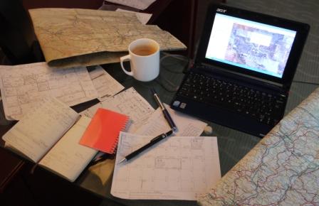
Snowbound in Silver City at a little over six thousand feet. Fighting the white quite fruitless. Instead, refreshing the plan for the journey east to El Paso, Texas. Studying ten day forecasts, looking for a suitable weather window to traverse the 8,230 feet Emory Pass – twice the height of Ben Nevis. And the elevation profiles on my maps, making sure daily targets are challenging, but remain art-of-the-possible.

Careful balance required. Conditions at eight thousand feet can be very fickle. Best to be cautious, as flexible as possible. Draw on experience of the earlier passes. Expect the unexpected. But need to commit to a plan as I’ve already made arrangements to stay with fellow cyclists in El Paso and beyond. People generally don’t mind change, so long as you let them know in good time. And don’t do it too often.

And the plan. Wait for expected daytime temperatures to rise above freezing. Tyres never good on ice. Reposition thirty or so miles east of Silver City at a US Forestry Service campground at the base of Emory Pass. Complete the traverse the next day – about twenty five miles so if conditions are less than ideal, plenty of time to be cautious. Then downhill for a couple of days to El Paso.

obpostlogo

Share

Storm brewing

December 17th, 2011

Storm brewing, shortly to sweep across the continental United States. Expectations of snow on high ground, even in the southern States. I’d been watching the evening Weather Channel with Joyce and husband Gene-Robert. Not good news. But at least I knew what was heading my way, able to plan accordingly.

I needed to reach Silver City, roughly 120 miles further east, and the next and final rendezvous with my parents. Between us a mountain pass in excess of 6,000 feet. And short days. Dark soon after four. I explored the options with host Mons, deciding to push for arriving a day earlier than planned, just ahead of the front. Clear the pass the next day.

Bold, but feasible, plan. If progress was slower than I might hope for, I could camp at altitude, a little beyond the pass. Amongst woods just shy of the New Mexico border. Then descent onto open ground. Vulnerable to winds sweeping in uninhibited.

obpostlogo

Share

Heading for El Paso

December 5th, 2011

Close by the Mexican border might be, but crossing close to San Diego leads to pretty much a dead end. The Baja California peninsular. So east towards El Paso. Following the US Adventure Cycling Association’s Southern Tier route.

P1070433

Over a thousand miles, it’s a journey through coastal mountains, across scrubby desert, sand dunes and past endless cacti. A series of mountain passes to cross, climbing up to over 8,000 feet. Over the Continental Divide, the backbone of North America.

P1070499

Challenges ahead. Desert winds strong enough to bring progress to an abrupt halt. Terrain affording little cover. Warm days bitter nights. At altitude, always a risk of winter snows.

obpostlogo

Share

Parental oversight

October 8th, 2011

Much, if not all, of my journey had been through uncharted territory. But now I was heading for Prince George, surprised to discover my parents had visited a decade or so earlier. They’d much more of an idea of what lay ahead than I did.

Knew they visited North America quite a bit, but not this far west. Had they, I enquired, seen bears? Yes, replied my Mum. But, there again, everyone but yours truly has.

obpostlogo

Share

Mountains to climb, plateau to cross

October 8th, 2011

Three weeks to Seattle. I’d miss Meg Ryan but would have the chance to meet up with an old school friend I’d not seen in, well, decades. Planned to ride together for a while, just as we’d done as teenagers back in Pembrokeshire.

P1060651

Plan was simple enough. Inland, due east, from Prince Rupert, through the imaginatively named Coast Mountains to British Columbia’s interior plateau. It sounded flat, but you could never be sure. Fertile ground for headwinds, especially as I’d an idea they’d still be mostly southerlies.

From Prince George, at the northern end of the plateau, I’d turn due south, heading for the winter resort of Whistler. Too early, I hoped, for snow. But I’d a warm bed booked in a hostel for a few days. Planned respite from camping, chance to dry kit out, and confirm the arrangements for the next stage.

A few days later and I’d be in Vancouver, back once more on the west coast. Arranged to stay with some fellow cyclists, and hoped to meet a Kazakh masseuse I’d met back in Kazakhstan, but now a Canadian citizen living in the city. I was curious.

I’d balked at trying to pick a route amongst the busy highways south over the border. Deciding instead to take a short hop on the ferry to Vancouver Island, night or two there, then a fastcat into the US and Seattle itself. Leaving me about five miles through the city.

Quietly pleased with my solution. A certain elegance, a simplistic beauty I thought. Just had to push the pedals, turn the cranks, wild camp and avoid any aggressive bears. Or moose.

obpostlogo

Share

South to Seattle

September 18th, 2011

route – pronounced r-out – the path you follow

Alaskan map

Not sure why I’d settled on Seattle as the next big goal, but I have. Got to cross Alaska and ride through Canada to get there, not a trivial undertaking in itself. It just seems intuitively right, logical even. Actually, a very old friend from school lives there, someone I used to ride around Pembrokeshire with as a teenager. Haven’t seen him for many years, and really keen to meet up with him again. Lots of catching up to do. There’s also a chance to ride with a fellow cyclist south of Seattle. Someone I’ve already met, whom I’d absolutely love to travel with. Think it would be a lot of fun. So much so, I’ve decided it’s a given that the timeline will fit.

Plan is simple. About 800 miles across Alaska, brief foray into Canada’s Yukon, then back into Alaska to catch a ferry from Skagway. Sailing along the Alaska Marine Highway to Prince Rupert in British Colombia, Canada. Then a further 1200 miles or so south to Vancouver, over the border back into the US and on to Seattle. Glad I’ve a multiple entry visa. Four border crossings. And, putting it all into a bit of perspective, the first stage of North America equates to riding from one end of the UK to the other. Twice. And a little bit left over.

[With especial thanks to friend and professional artist, illustrator and author Claudia for the sketch map – please do visit her at www.claudiamyatt.co.uk. And a big thank you to Linda in Anchorage for sage advice on routes, mapping and quite a bit more. Plus Amelia for the Yukon guides and maps]

Share

Southbound to… Somerset

May 23rd, 2011

ken-in-oz-web

Southbound to Somerset. Actually the one on the north coast of Tasmania, just off the southern most tip of Australia. And a town rather than a county – or shire as they’d say here. Strictly speaking, I suppose, I am heading towards Somerset UK, but that’s a little further off…

A little short of the half way point along the east coast – Queensland’s capital Brisbane – the plan is to avoid the city proper by detouring inland towards the Glass House Mountains, Lake Somerset and the Wivenhoe Dam. Some blame the latter for much of the flooding in Brisbane back in January.

Then it’s back to the coast at Southport. Just south of Brisbane. Postcards to send to friends and relatives in Lancashire’s namesake. Then plunging south to Sydney. Onwards to Melbourne and the overnight ferry to Tasmania – Tassie.

obpostlogo

Share

Southbound to Sydney…

March 3rd, 2011

Southbound to Sydney from Ken Roberts on Vimeo.

Southbound to Sydney. Certainly. But drawn towards Tasmania. And Somerset. From where I hail from in the UK. Has to be done.

Share

Change of direction

November 30th, 2010

Heading south. At least that’s how it felt. Just as it seemed I’d been riding east since crossing from Kazakhstan. Truth was, it’d been south easterly the whole way. Maybe east south east. Cardinal points confusing. But now, at the very least, in the turn. No longer wedded to the G312 National Road that ran across the entire breadth of China.

Through the mountains of western China, across the Gobi desert, steep climbs and rolling descents east of Lanzhou, again beyond Xi’an. At times it seemed madness. But now the wide flood plain of the Hanshui River. Sudden swift progress.

In reality, the southerly plunge to Hong Kong would start a few days beyond the city of Wuhan. My next major stop. Couple of hundred miles further on. And yet the change of direction already seemed largely complete.

Share

Road ahead

August 24th, 2010

“The difference between ordeal and adventure is… attitude”

Planning tools - web

I’d slept in a petrol station, on the floor of a roadside cafe, and had a suspicion I’d shortly be adding a brothel to the list. Sometimes one has to suffer for one’s art. And I don’t mean in the house of ill-repute. No. I was thinking more about what my mother would make of it. Or me. Perhaps I’d better take the long way home.

Annotated map - web

I’d been looking at the road ahead, roughly three weeks to the city of Lanzhou, much of it across the Gobi desert. A great deal of it barren, sparsely populated. My map had its limitations, much of it down to its small scale. I’d learnt to augment it with a blog I’d found, a very useful account by a fellow English cyclist who’d come the same way. Lots of annotations.

Google Earth had good imagery of the region, useful for seeing what’s there. Or in the desert, what’s not. Like a couple of settlements shown on my map that simply don’t exist on the ground. Useful to know if you’re planning on using them as watering stops. And one helpful individual had populated much of the route with an abundance of photographs showing exactly what the terrain, and the road, looked like.

Google Earth - web

I’d also found a website where I could look up place names in Simplified Chinese. After a while I’d noticed that all the towns seemed to have remarkably similar names – actually the same. Re-reading the website, I realised I’d be meticulously copying out the expression for ’populated place’ – about ten times..

Beyond the city of Urumqi, the Turpan Basin. Described as the hottest place in China. Across the ninetieth line of longitude. One quarter of the way around the world. Next Hami, large town or small city perhaps, but then little before reaching the Silk Road watering hole of Dunhuang. Brief respite, then on towards the city of Lanzhou. Gritty road ahead.

[The author is hugely indebted to Steve Tallon for sharing his own account of cycling across the Gobi desert – see www.turnrightforjapan.com – ironically, a website that seems to be blocked in China. And who, judging from his photographs, found exactly the same branch of a well-known fast food chain in Urumqi as I did. Opposite the Sheraton.

Place names translations courtesy of www.dbr.nu/data/geo/placenames/geo_china_placenames.php]

Share
Terms & Conditions of Use | Copyright © 2009-2024 Ken Roberts