I’d planned to take the ferry south from Skagway. Why, Rick had asked whilst I’d being staying in his cabin near Haines Junction? Haines was closer, and the next port of call for the ship. And I was a bit pressed for time. So I’d decided to take the Haines Road due south and ride for Haines. About one hundred and fifty miles. Day and a half to get there.
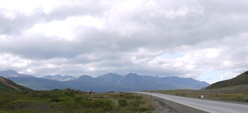
A steady climb out of Haines Junction. Flatter sections around Kathleen Lake, past Klukshu First Nation village. And then lengthy uphills, insidious rather than steep, past Million Dollars Falls. Over the southern boundary of the Yukon into Canada’s British Columbia Province.
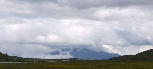
Next the Chilkat Pass, highest point on the road at over three and a half thousand feet, on beyond the Three Guardsmen mastiff, its tallest peak more than six thousand feet. Then the descent to the US border and a return to Alaska. Fifty or so miles into Haines, a further five to the ferry terminal.
The plan was simplicity itself. Push as far as I could on the first day, as close to the US border as possible. Wild camp before I lost the light. Rise early. Into Alaska, find the roadhouse I’d been told about and refuel with a decent breakfast. Then press on to the ferry.

Tags: British Columbia, Haines, Haines Junction, Haines Road, Yukon
Leave a Reply